FHNW Muttenz visual localization dataset
A large-scale, real-world high-resolution street-level visual localization dataset with sub-centimeter-accurate 6-DoF ground-truth poses — built to test whether visual localization can match survey-grade GNSS positioning (< 5 cm accuracy under favorable conditions).
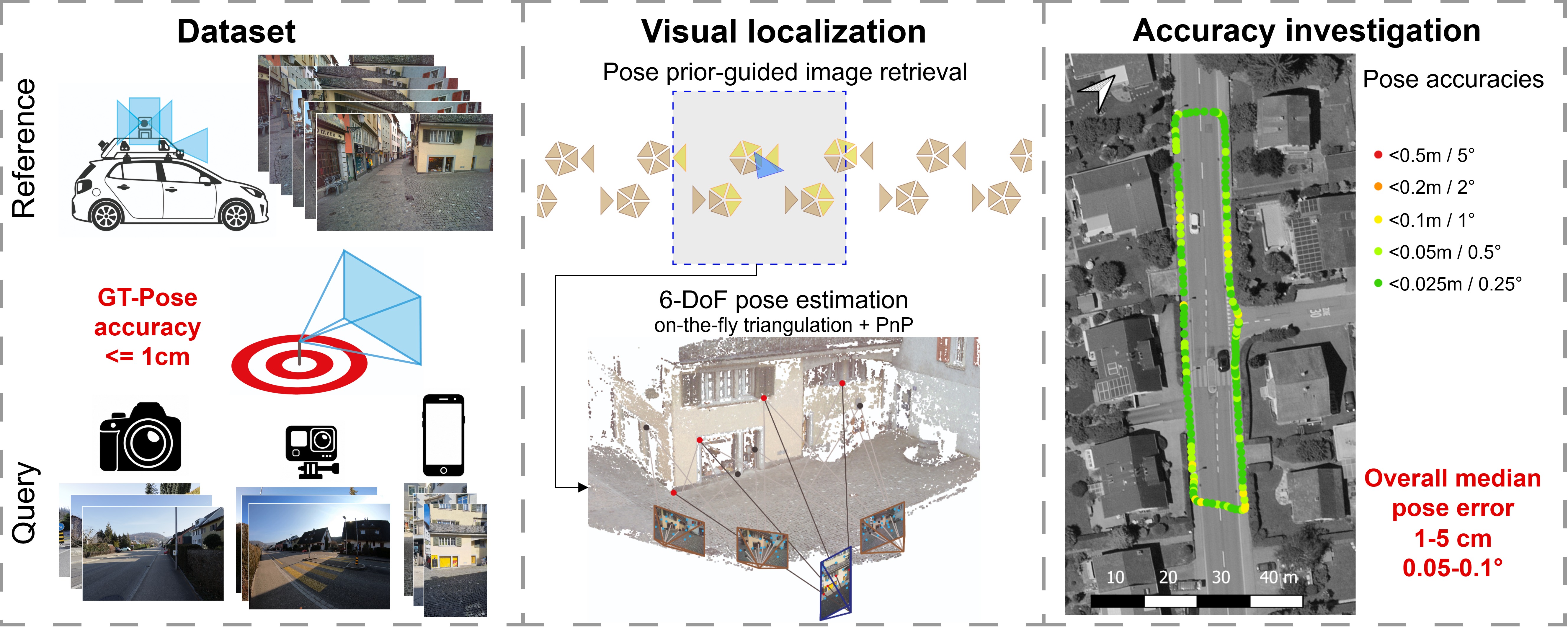
At a glance
| Coverage | Contiguous street network, ~10 km |
| Reference mapping campaigns | 2 (2023, 2025; ~1.5 years apart) |
| Query sequences | 20 (5 scenes each captured with 4 cameras) |
| Ground-truth pose accuracy | < 1 cm co-registration; 1–3 cm georeferencing |
For questions open an issue on GitHub.